Saturday, May 14, 2016

The Warming Science Commentariat - 4

Fig. 1
I. Introduction

This Dredd Blog series is akin to a series like one might find at Media Matters.

However, it is limited in subject matter to the warming climate commentariat echo chamber which is still promoting climate change myths or erroneous climate change memes.

Other Dredd Blog series criticize pop warming commentariat rhetoric and mantras have been more general in scope.

This series is now tending to focus most on sea level change (SLC) issues that are improperly presented by sources that are otherwise quite aware (The Warming Science Commentariat, 2, 3).
Fig. 2

II. Cherry Picking

One of the most widespread problems within the warming commentariat is the improper "cherry picking" of data.

I have noticed that cherry picking is the workhorse method for data usage by denialists.

Thus, the serious global warming / climate change reporters and scientists should not emulate that practice:
"Cherry picking, suppressing evidence, or the fallacy of incomplete evidence is
Fig. 3
the act of pointing to individual cases or data that seem to confirm a particular position, while ignoring a significant portion of related cases or data that may contradict that position. It is a kind of fallacy of selective attention, the most common example of which is the confirmation bias. Cherry picking may be committed intentionally or unintentionally. This fallacy is a major problem in public debate."
(Wikipedia). The good side of cherry picking is picking the better fruit on a cherry tree, but it is not a good practice in the search for the whole truth and nothing but the truth of SLC.

III. Getting Loose

Let's look at an example from an otherwise sound source, Climate Central.
Fig. 4

Their paper: "UNNATURAL COASTAL FLOODS: Sea level rise and the human fingerprint on U.S. floods since 1950" (PDF) is a good example.

Three errors strike me right off the bat, just from the title: 1) the implication that humans are "unnatural"; 2) "since 1950" indicates that they did not have enough data to grasp the full picture; and 3) the big SLC picture is not in their thinking in a robust way.

I will address these three errors out of order.

Let's look at number three first, in the context of my take on their position, (remember this?):
Fig. 5
"[oft heard meme] ... no single weather event can be linked directly to ... global warming."

("President OBAMA: You know ... we can’t attribute any particular weather event to climate change.").
...
Now who would want us to believe that?

"Why is that meme a false meme as the title of today's post indicates?" you may ask.

Since we deserve an answer, let's contemplate this problem with an exercise in deductive logic, premised on the false meme under our consideration today:
1) No single weather event can be linked directly to global warming;
2) all weather events are single weather events;
3) therefore, weather events can't be directly linked to global warming.
(see Doctors of Philosophy Make Phd. Mistakes). To see what the propagandists and/or apologists (who originally fabricated this false meme) are advancing, let's analyze this a bit further by considering a realistic meme:
1) Weather is a function of the global climate system;
Fig. 6
2) all single weather events are parts of the global climate system;
3) the global climate system has been damaged by global warming;
4) therefore, all single weather events are part of the global climate system that has been damaged by global warming;
(see How Fifth Graders Analyze Hurricane Sandy). See the subtlety that the false meme forces, and see the bigger picture the accurate meme "global climate system" connotes?

All single weather events are systemic indicators of the global climate system which any single weather event is an integral part of.
(False Climate Change Meme Infects The President, 2). When a system is damaged anything within that system suffers a systemic damage (systemic "relating to or involving a whole system: [e.g.] The problems are systemic and will only worsen.").

Fig. 7
In their paper Climate Central tries to compare systemic coastal flooding within the damaged climate system with another type of coastal flooding within a climate system that ostensibly does not exist: "the human caused climate system" (see The Damaged Global Climate System - 5).

In that view "both systems" (anthropogenic & natural) do some flooding exclusively (evidently because humans are not a part of the damaged global climate system?)

That is a false equivalence since humans are natural and are a part of the one planet Earth which contains only one global climate system (You Are Here).

IV. Getting Lost

The second error ("since 1950 at 27 U.S. tide gauges") is caused by the use of too few years, too few tide gauges, at too few locations.
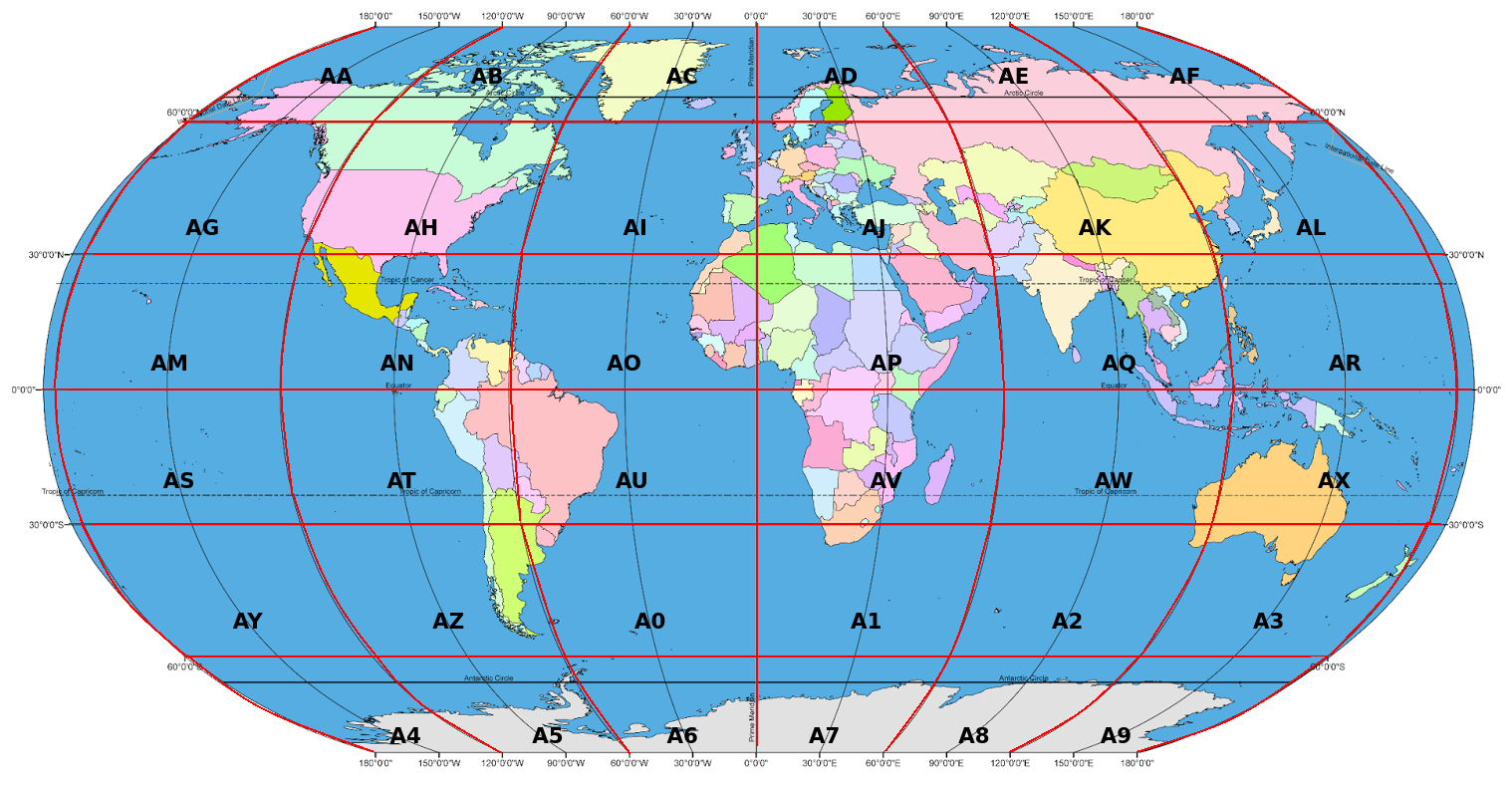
Fig. 8

Regular readers know that I use a little over 1,400 tide gauge station records, one of which goes back to circa 1775 (Weekend Rebel Science Excursion - 54).

In short, Climate Central's paper takes the global out of "global."

Their bathtub model mentality also shines through in the first paragraph of their paper: "It is very well established that global sea level is rising" (Section 01, p.7).

I did a global search on all the text in their paper, only to find that they also do not mention the other part of the global equation, sea level fall (SLF).

Fig. 9
A global mean average, or even a U.S. mean average, would have to include SLF to represent an understanding of global SLC.

Rise is change but so is fall.

SLF is substantial at some coasts of the U.S. and also at other coasts around the globe (Proof of Concept - 3, 5; and see Fig. 3).

Scientists have known for over a century that sea level behaves differently (non-intuitively) around ice sheets that are melting (Woodward (1888), cf. Mitrovica video below).

V. Getting Scared Out of our Minds

Regular readers also know about one of the the main drivers of "fashionable", pop scientific studies about climate change:
A recent paper by the biologist Janis L Dickinson, published in the journal
Fig. 10
Ecology and Society, proposes that constant news and discussion about global warming makes it difficult for people to repress thoughts of death, and that they might respond to the terrifying prospect of climate breakdown in ways that strengthen their character armour but diminish our chances of survival. There is already experimental evidence suggesting that some people respond to reminders of death by increasing consumption. Dickinson proposes that growing evidence of climate change might boost this tendency, as well as raising antagonism towards scientists and environmentalists. Our message, after all, presents a lethal threat to the central immortality project of Western society: perpetual economic growth, supported by an ideology of entitlement and exceptionalism.
(Convergence - Fear of Death Syndrome). This makes those who have been educated with fear a bit reluctant to consider the evil, Halloween gravity of Newton (The Ghost-Water Constant, 2, 3, 4, 5, 6, 7, cf. The Gravity of Sea Level Change, 2, 3, 4).

Whatever the reason for not being the most careful about the greatest threat, it is not a valid reason.

VI. Oh Yeah, The Graphs

Before closing let me mention the graphs which I haven't already mentioned.

Fig. 11
These 12 graphs are from the batch generated by the new software module I wrote about in Zone AH, Quadrant SE, Subquadrant NE - 2 and The Extinction of Robust Sea Ports - 5.

The tide gauge station recordss I graphed in those two posts, and in today's post, are in zones that have one or more tide gauge station data sets that begin in the 1800's.

They also show that tide gauge stations installed and operated after that time are at a different sea level than their predecessors.

Which means that those newer records ought not to be read alone, to the exclusion of the older ones (like Climate Central's study mistakenly did).

VII. Conclusion

The Climate Central paper alleged that all tide gauge station records are newbies:
"Only a small number of studies, however, have attempted to identify how much of the rise can be attributed to human influence [why would they, we all know that all Anthropogenic Global Warming is caused by Anthros], and all of these studies have depended upon analyses of the relatively short tide-gauge record ..." [so you Climate Central doods used data beginning in the ancient 1950s eh?]  (p. 7)
...
"Across the 27 study gauges [out of over 1,400 easy to access PSMSL stations woo hoo!], only 33% (16-60%) of observed flood days since 1950 [hey you guys, you missed SLF beginning circa 1775 when the Greenland Ice Sheet began to melt] would still have exceeded local nuisance flood thresholds after deducting the human contribution to global sea level rise from water level records. Stated differently, two-thirds (40-84%) of the 8,726 total flood days may be said in this framework to have been human-caused via climate change." (p. 9)
(ibid, emphasis added). Wrong, the Industrial Revolution is the baseline of the time frame that began circa 1750, and there are records going back over the majority of that time frame.
Fig. 12

That Industrial Revolution was a vision-less excursion by fat-cat one percenters driven by their greed and screw-everyone-else attitude.

At best, Climate Central's paper, dripping with a Stockholm Syndrome attitude, is an authoritarian exercise in inadvertent enabling (The Authoritarianism of Climate Change).

The next post in this series is here, the previous post in this series is here.


Friday, May 13, 2016

The Extinction of Robust Sea Ports - 5

Fig. 1
Today I want to add to a recent post (Zone AH, Quadrant SE, Subquadrant NE - 2), and discuss some of the difficulties facing officials who run seaports. 
Fig. 2

Fig. 3
Specifically, I am talking about the difficulties caused by sea level change (SLC) which is caused by global warming which is caused by burning fossil fuels.
Fig. 4

Fig. 5
The graphs shown in today's post were selected because they are graphs of zones which contain tide gauge stations that began keeping records in the 1800's, but also contain  tide gauge stations that began keeping records years later.

The older seaports are the more vulnerable to SLC because, as these graphs generally show, sea level tends to be at a different level now compared to when the seaports were built.
Fig. 6

Fig. 7
In Fig. 1 and Fig. 2 I have marked the beginning of a historical record, from tide gauge stations, with a small red square.

I have marked the ends of those records with a small blue square.

Another seaport complication is that there are two types of SLC, sea level fall (SLF) and sea level rise (SLR).

The graph at Fig. 3 shows a case of SLF, the graph at Fig. 11 shows a mixed case of both, while the other graphs tend to show cases of SLR.

Remember that infrastructure around seaports will be more exposed in older ports than they will be in newer ports, whether they face SLR or they face SLF.
Fig. 8

Fig. 9
Infrastructure around seaport areas where the land surface gently slopes upward, as one moves inland away from the coastline, will be more vulnerable to SLR than seaports in areas with infrastructure on more sharply upward sloping terrain.
Fig. 10

Fig. 11
Seawater travels inland under the surface of the land for substantial distances under most conditions.

It can undermine infrastructure unexpectedly that way.

When flora begin to die out from being exposed to salt water, the infrastructure can also soon be subjected to damage from incursion.

This happens well before the seawater actually breaches the surface of the land (flooding) which that infrastructure is built upon (The Extinction of Charleston, The Extinction of Philadelphia, The Extinction of Washington, D.C., The Extinction of Boston, The Extinction of Miami, The Extinction of Manzanillo,The Extinction of Providence, The Extinction of Chesapeake Bay Islands).

To the contrary, in areas where SLF is taking place,  the infrastructure can be isolated as the waters move away from the high tide mark, and as the seaport becomes more shallow.

Marine engineering and construction firms face the problem of determining when and how much SLC will take place well ahead of the time when construction would have to begin in order to be timely (Peak Sea Level - 2).

Add to that the logistics nightmare of all seaports needing attention at relatively the same time.

You know, SLC is taking place on a global scale, rendering thousands of ports vulnerable at about the same time.

There are thousands of ports, but only a relatively small number of competent marine engineering and construction companies available to help the thousands of ports facing increasing vulnerability.

Add to that the political tugs and pulls on public bodies, such as port authorities who have political realities to face, and "Houston we have a problem" (The Extinction of Houston).

Some of those port authorities are climate change deniers who have to deal with the public and higher ups in the federal government.

Most of the federal officials are not climate change deniers (Global Climate & Homeland Insecurity - 2).

In some places the political tug of war will exacerbate the issues, adding even more difficulty to the substantial and still underestimated predicament  (Why Sea Level Rise May Be The Greatest Threat To Civilization, 2, 3, 4, 5).

Even one of those difficulties or one port can have a domino effect which affects the viability of other ports "down stream" from the problem or predicament (The top 10 metropolitan port complexes in the U.S.).

The next post in this series is here, the previous post in this series is here.


Thursday, May 12, 2016

Where The Power At?

Ode To Et Alia
by Dredd

glistening in the slime
of the epi
slithering in the time
of the uni
i.e.
the unity of confusions
smacks the ass
of newborn delusions
bathing in the bathwater
thrown away with the babies
where the
modern ancient dumb smart
waiters wait for the power
...
that does not exit.


Wednesday, May 11, 2016

Zone AH, Quadrant SE, Subquadrant NE - 2

Fig. 1 Historical sea level records
The graph at Fig. 1 shows the historical record of tide gauges along the North Eastern Atlantic seaboard, in one Dredd Blog zone.

The oldest tide gauge station record begins circa 1856, which is 16 decades, or 160 years ago.

The oldest tide gauge station in that graph is "The Battery" which is located in the New York City area.

In technical terms, that one of several records is called "PSMSL tide gauge station Number 12" (New York, The Battery).

Fig. 2 The Battery, NYC
The other tide gauge stations on that graph are all in Dredd Blog Zone AH, Quadrant SE, Sub-quadrant NE (AH.SE.NE, cf. Fig. 5, Fig. 6).

A zone mean average (a blending of all individual tide gauge station records in that zone into one flow) is depicted in the first post of this series (Zone AH, Quadrant SE, Subquadrant NE).

In histories, there are many loose ends, staggered beginnings, and the like, so, when dealing with tide gauge station records, one needs to arrange them in a manner that informs the readership.

That is because different places build and install, for example their tide gauge stations, at different times, as Fig. 1 shows.

Fig. 3 The Fingerprints
For example, the small red squares on the graph indicate when a tide gauge station began to keep records (Fig. 1).

The end to those beginnings is depicted by the small blue squares on the right side of the graph.

If an individual tide gauge record is used to characterize the entire area, a distorted viewpoint can be generated.

What I want readers to grasp is that if one is not careful one can inadvertently isolate a tide gauge station's historical record to its beginning, or to some other annual spot, in a manner that does not sufficiently reflect the total picture.

For example, by way of excluding other much older, or much younger, tide gauge station records, different sea level rise or sea level fall values can be asserted.
Fig. 4 A two-gauge zone

In other words, the resulting partial graph can more easily be used to tell a false scientific story unless the blogger points out the context.

For example, Fig. 4 shows a zone with only two tide gauge stations that began to keep records years apart from one another.

If only one of those tide gauge station records is used, to the exclusion of the other, a different picture of what is actually happening in that zone can be alleged.

Fig. 5 Dredd Blog zones
For another example, Stn. 12, The Battery, begins at a sea level value which indicates that the area has seen a continual trend of sea level rise of a significant degree (compared to some other areas).

I did that type of sectionalized graphing in SLC Fingerprints R Us, because in that post I was comparing different types of sea level record flows, using global mean average values, and temperature records (BTW, the distinctions were stark).

The purpose of that exercise was to dissect "global mean average" to reveal basic components.
Fig. 6 Dredd Blog Quadrants & Sub-quadrants

I wanted to illustrate how it subtly smooths over the real picture of sea level change reality.

The software module I wrote to generate Fig. 1 does the same thing to all of the "Dredd Blog zones" which regular readers hear of from time to time.

Notice that Fig. 3 shows another way to dissect a tide gauge historical sea level record set.

It shows the normal record, then pulls out individual components in terms of their partial contribution to the total picture.

In other words, Fig. 3 is a composite view that shows the whole as well as the parts which add up to the whole.

The whole exercise is conducted to, among other things, expose the fallacy of thermal expansion as a major player in historical sea level change, and to eschew improper use of "global mean average"  (cf. On The Evolution of Sea Level Change - 2, The Bathtub Model Doesn't Hold Water).

The previous post in this series is here.

These are the PSMSL stations in Zone AH.SE.NE depicted in Fig. 1:

1) Stn. #1230 : DIGBY
2) Stn. #1158 : YARMOUTH
3) Stn. #1259 : BOUTILIER POINT
4) Stn. #96 : HALIFAX
5) Stn. #1654 : TRENTON
6) Stn. #1153 : CAPE MAY
7) Stn. #180 : ATLANTIC CITY
8) Stn. #366 : SANDY HOOK
9) Stn. #12 : NEW YORK THE BATTERY
10) Stn. #1637 : BERGEN POINT STATEN IS
11) Stn. #519 : MONTAUK
12) Stn. #875 : PLUM ISLAND
13) Stn. #848 : PORT JEFFERSON
14) Stn. #362 : WILLETS POINT
15) Stn. #856 : NEW ROCHELLE
16) Stn. #1068 : BRIDGEPORT
17) Stn. #429 : NEW LONDON
18) Stn. #430 : PROVIDENCE STATE PIER
19) Stn. #351 : NEWPORT
20) Stn. #776 : BUZZARDS BAY
21) Stn. #367 : WOODS HOLE OCEAN INST
22) Stn. #1111 : NANTUCKET ISLAND
23) Stn. #775 : SANDWICH MARINA CAPE COD CANALENTRANCE
24) Stn. #235 : BOSTON
25) Stn. #288 : SEAVEY ISLAND
26) Stn. #183 : PORTLAND MAINE
27) Stn. #1279 : ROCKLAND
28) Stn. #525 : BAR HARBOR FRENCHMAN BAY ME
29) Stn. #1524 : CUTLER II
30) Stn. #1081 : CUTLER
31) Stn. #332 : EASTPORT


Monday, May 9, 2016

The Warming Science Commentariat - 3

Fig. 1 Hippy Physicist
The "warming commentariat" continues to promote junk-science scenarios.

They do so even though the fundamental science to the contrary of their assertions has not changed since Newton (there are even some rumors going around that the law of gravity even goes back in time and place [You Are Here] to a time and place before Newton ... cf. Fig. 1 and this).

Here is a general narrative of the mythical thermal rap:
While climate science was still in its infancy during 1925 [wrong The Exceptional American Denial], a human forced warming of the globe was starting to kick into higher gear. A signal of atmospheric warming since the 1880s was beginning to develop [wrong @25 years into the industrial revolution, the Greenland ice sheet was already beginning to melt: Weekend Rebel Science Excursion - 54]. Though unclear [wrong it is "unclear" to deniers today because their mind is unclear, not because the science is unclear: Inhofe's One Man Troofiness Crusade], it was becoming apparent that the airs of the world were building up heat. But the waters of the world were providing a strong signal that the Earth was accumulating that heat more and more rapidly.

Sea level rise, at that time driven by thermal expansion [wrong: The Warming Science Commentariat] and by a later small but growing contribution from glacial melt [wrong: ice sheets were beginning to melt circa 1775: Proof of Concept - 5], took its first leap higher. And from 1925 through 1992, the average rate of sea level rise more than doubled to 1.9 millimeters per year. It was a sign that the Earth was warming more and more rapidly and that the heat was showing up in still more thermal expansion of the world’s waters [wrong: the melt of the Greenland Ice Sheet in the late 1700's, and the resulting sea level change was not caused by thermal expansion: The Warming Science Commentariat - 2].
(Scribbler, [editing added between brackets]). The warming commentariat needs to realize that physics is real even though some of the major discoveries that impact sea level change were known in Isaac Newton's time (e.g. gravity, Fig. 1).

The hypothesis of the application of the law of gravity to ice sheet dynamics was published in scientific papers long ago: Woodward (1888).

The application of the law of gravity to ice sheet dynamics is not junk-science, like the above narrative is:
Because every ice sheet and glacier has a unique location and size, each one creates a pattern of response in the ocean as individual as a fingerprint. "The physics behind understanding these fingerprints is very well understood," Tamisiea said. "It's like the tides." He and Jerry Mitrovica of Harvard University have calculated the fingerprints of East and West Antarctica and Greenland around the globe. "We do each ice sheet individually so we can use the latest GRACE analysis," Tamisiea explained. "You can sort of add the effects up and see what the result is for any given location."

As any ice sheet melts, sea levels along coastlines as much as 1,500 miles
Fig. 2 The Battle of the Bulge
(2,000 kilometers) away will fall as seawater escapes from the reduced gravitational pull and the crust lifts. The escaping seawater flows clear across the equator: the melting of Antarctica affects the U.S. East and West coasts, and Greenland's disappearance impacts the coastline of Brazil. These regional differences are significant -- such as in the case of the East Coast of the United States.
(The Fingerprints of Sea Level Rise, NASA JPL). Regular readers know that I call this "escaping" water that is already in the ocean "ghost-water" because very, very few observers "see" it  (The Ghost-Water Constant, 2, 3, 4, 5, 6, 7).

I call it that because the warming commentariat cannot see it even though it is the second largest contributor to sea level change, whether that change is sea level rise or sea level fall (see Fig. 2, and The Battle of the Bulge).

Fig. 3 Geographical Sources
"Displacement" is what I call the number one sea level change factor.

Displacement is what happens when Ice sheet melt-water and calved icebergs leave a land mass to enter the ocean.

"Displacement" is also a well known scientific term (Water Displacement).

In contrast to ghost=water, the warming commentariat can see displacement a little bit, but they do not see it as a major player.

Those two (displacement & ghost water) are the two major players in sea level change in terms of being related to ice sheets.

The 5.1% thermal expansion, etc. make up the minor factor.
Fig. 4 Geophysical Sources

Those three factors are the "geophysical factors" at all three land based sources of sea level rise (Greenland, Antarctica, and mountain glaciers).

They are depicted in a graph concerning the history of sea level in one area of the globe (Fig. 4).

I call the land locations where those major geophysical dynamics originate "geographical sources" (Fig. 3).

The bottom line is that global warming induced by the burning of fossil fuels causes the geophysical dynamics of displacement and ghost-water relocation at Greenland, Antarctica, and mountain glaciers that flow into the oceans.

Those are the major factors, with the added minor factor of thermal expansion of the ocean from global warming, along with land uplift.

Those geophysical dynamics operate at all of the relevant geographical locations of the globe (geographical: SLC Fingerprints R Us, 2; both:  The Ghost-Water Constant - 4).

The bottom line is: The Bathtub Model Doesn't Hold Water.

The next post in this series is here, the previous post in this series is here.


Sunday, May 8, 2016

Arctic Sea Ice & Antarctic Sea Ice Are Different Types

Fig. 1
I. Likenesses

There are some obvious likenesses in the two polar located sea ice masses, however, what is usually not expressed is the differences between the two entities.

The graphs at Fig. 1 and Fig. 2 illustrate the outward appearance of the Greenland and Antarctica sea ice in terms of size in km2 (square kilometers), and it terms of increase and/or decrease in the area of ocean they cover at a given time.

The extent or area of sea ice is not the same as its volume or mass, which is expressed in km3 (cubic kilometers).

Fig. 2 Trend in Arctic sea ice
I explained the difference in a previous Dredd Blog series (How Fifth Graders Calculate Ice Volume, 2, 3, 4, 5).

In terms of volume or mass, both areas are in general decrease, which is expressed in terms of cubic miles (mi3) or cubic kilometers (km3).

This is a fundamental distinction that applies equally to the two, but it is also one of the reasons why some deniers do not understand the difference between the two entities (more on that later in this post).

II. Differences

A major difference between them is that the Antarctica sea ice is an ice shelf, while the Arctic sea ice is more properly called a polar ice cap.

Fig. 3 Sceptical Science
The reason for that is the Antarctic Ice Sheet over land extends out over the sea as an ice shelf, whereas the Arctic sea ice is not an extension of an ice sheet, thus it cannot properly be called an ice shelf.

In other words the Antarctic Ice Sheet over land extends over the ocean to become the Antarctic Ice Shelf around the land mass, however, the Arctic sea ice is not an ice shelf because it is not an extension of, an ice sheet on land extending out over the ocean.

This is one reason the extent / area of the Arctic sea ice is shrinking in size in terms of square miles (or square kilometers), while the Antarctic exhibits times of increase, in terms of square miles (or square kilometers).

Notice Fig. 3 for a comparison of the two areas at maximum ice extent and minimum ice extent on a general annual basis.

The graph at Fig. 4 shows that Arctic sea ice is on an annual record pace.

A peer-reviewed paper on the issue points out why the maximum extent is increasing:
In contrast to Arctic sea ice, sea ice surrounding Antarctica has expanded,
Fig. 4 Arctic sea ice extent
with record extent in 2010. This ice expansion has previously been attributed to dynamical atmospheric changes that induce atmospheric cooling. Here we show that accelerated basal melting of Antarctic ice shelves is likely to have contributed significantly to sea-ice expansion. Specifically, we present observations indicating that melt water from Antarctica’s ice shelves accumulates in a cool and fresh surface layer that shields the surface ocean from the warmer deeper waters that are melting the ice shelves.
(Nature Geoscience, 2013). A more recent paper is in accord with that summary:
Meltwater tends to stabilize the ocean column, inducing amplifying feedbacks that increase subsurface ocean warming and ice shelf melting. Cold meltwater and induced dynamical effects cause ocean surface cooling in the Southern Ocean and North Atlantic, thus increasing Earth's energy imbalance and heat flux into most of the global ocean's surface. Southern Ocean surface cooling, while lower latitudes are warming, increases precipitation on the Southern Ocean, increasing ocean stratification, slowing deepwater formation, and increasing ice sheet mass loss. These feedbacks make ice sheets in contact with the ocean vulnerable to accelerating disintegration.
(Hansen et al., 2016). The ice shelf is melting from below and that increasing volume of cold melt water re-freezes further out from where it originated during the melting of the bottom of the ice shelf.

It melts again during the summer (Fig. 3) to result in a minimum extent that is about ten times smaller than the maximum extent (Fig. 1).

The Arctic sea ice on the other hand is in a constant shrinking trend (Fig. 2).

III. Antarctica Mass Volume Loss Confirmation

A study of the gravitational loss indicates a volume / mass loss:
"Princeton University researchers "weighed" Antarctica's ice sheet using gravitational satellite data and found that during the past decade, Antarctica's massive ice sheet lost twice the amount of ice in its western portion compared to what it accumulated in the east. The researchers used monthly data from GRACE, or the Gravity Recovery and Climate Experiment, a dual-satellite mission that measures gravity changes; as Antarctic land ice melts, the reduction in ice mass is picked up by GRACE. In the past 11 years, the Antarctic ice sheet lost 92 billion tons of ice per year, which, if stacked on the island of Manhattan, would be more than a mile high — more than five times the height of the Empire State Building. As shown in the figure above, from Jan. 2003 to June 2014, the vast majority of ice loss was from West Antarctica's Amundsen Sea region (box a) and the Antarctic Peninsula (box b) that winds up toward South America. The ice sheet on East Antarctica (box c) primarily thickened during that same time. The color scale indicates mass — equivalent to centimeters of water — of the land ice, with red denoting the largest loss and blue standing for the largest gain. (Image by Christopher Harig, Department of Geosciences)"
(Antarctic ice sheet is melting faster, emphasis added). Recent events in East Antarctica show that ice mass loss there is happening now and will increase in the same manner as West Antarctica is (The Ghost-Water Constant - 7).

Serious sea level rise potential from Antarctica is the metaphorical equivalent of a "10 month pregnancy in a woman" ... overdue  ("This Century" and "Global Dimming")

IV. Conclusion

The counter-intuitive reality is that as the Antarctica ice sheet and ice shelf melt from below the surface, the cold melt water goes to the ocean surface to re-freeze in winter, increasing the extent of the ice shelf.

It is a sign that the ice volume / mass is decreasing not increasing.