 |
| Fig. 1 The SLC picture @ W. Africa |
Those are the software modules that were lost when the errant operating system's installation/upgrade program trashed them some time back.
 |
| Fig. 2 Geographical contributors |
 |
| Fig. 3 Geophysical dynamics |
"Displacement" describes melt water or icebergs entering the ocean from ice sheets or glaciers on land masses.
"Ghost-water" describes the movement of ocean water that has been pulled close to a land mass (by the ice mass gravity - then released as the ice mass gravity diminishes along with the ice), then released and relocated toward the equator (not unlike lunar gravity tides).
 |
| Fig. 4 Ocean water temperatures |
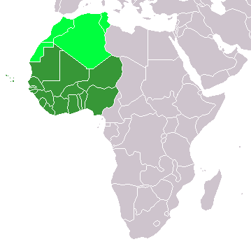
The area I chose to use in today's post is West Africa (Fig. 6), where nations such as Ghana, Togo, and Mauritania are currently being plagued with damaging SLC.
 |
| Fig. 5 Where the action is |
The graph at Fig. 3 shows the separate contributions of "Displacement," "Ghost-water," and "Thermal, etc." (clearly indicating once again that "Thermal, etc." is the minor, not the major player in SLC).
The graph at Fig. 2 shows us that up until now Greenland has been the major geographical influence on the SLC taking place in the W. African locations we are focusing on in this post (Fig. 5).
Foreign Policy magazine has recently published an article that describes the damaging action taking place in that area:
"The tide is just starting to come in when David Buabasah begins nervously checking the waters creeping up the coastline toward his partially destroyed home.(West Africa SLC). One statement in the quote ("Twenty years ago, Fuvemeh was a thriving community") is given higher significance, especially if you look at the SLC taking place there 20 yrs. ago (~1996).
As the high tide mounts the steep shore of this small Ghanaian fishing village perched on a shrinking peninsula between the Atlantic Ocean and the Volta River estuary, he and other inhabitants prepare for the worst.
“When the big waves come, they can easily kill you. Last week, the ocean took away part of my house while my family was sleeping inside,” says the 32-year-old fisherman, gesturing toward a crumbling brick wall and a pair of door frames, the only remains of his family’s compound.
Fig. 6 West Africa (dark green)
Growing stronger by the minute, the tide begins to push wave after wave into the village, pounding the dilapidated dwellings with unrepentant force. House walls collapse under the fury of the ocean, and huge pools of saltwater fill the center of town. Those whose houses are the closest to the shoreline can only watch as the waves carry away all of their belongings.
Twenty years ago, Fuvemeh was a thriving community of 2,500 people, supported by fishing and coconut plantations that are now completely underwater. But in the past two decades, climate change and industrial activity — such as sand mining and the construction of dams and deep-sea ports, which trap sediments and prevent them from reaching the coastline — have accelerated coastal erosion here. Gradually but inexorably, the ocean has swallowed up hundreds of feet of coastline, drowning the coconut plantations and eventually sweeping away houses."
In the area we are focusing on in today's post, an abrupt sea level fall trend began to take place circa 1980 (Fig. 1).
That trend lasted until it bottomed out circa 1986, at which time a steep sea level rise trend began.
During that sea level fall era people naturally built structures closer and closer to the receding ocean (a la Miami Beach, FL).
Eventually the sea level fall trend turned back on them, beginning circa 1987.
It established and now perpetuates the current upward trend which is causing the problems that will be seen more and more as time goes on its SLC way.
This is the same problem that plagues the east coast of the U.S.eh? (e.g. The Extinction of Chesapeake Bay Islands).
This SLC factor, since it is global, gives new meaning to "we are the world."
The previous post in this series is here.
"we are saving our own lives" ... take heed Humble Oil-Qaeda.
"Zero" is the Prime Meridian ...
ReplyDelete